Kentucky
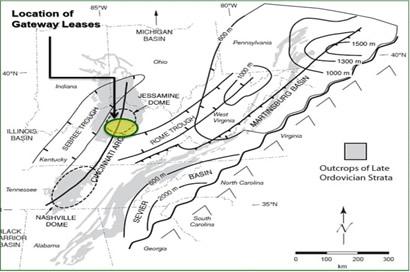
Structurally Jumbo Oil Field lies along the Northern tip of the Cincinnati Arch
Cincinnati Arch is the manifestation of the Appalachian Foreland Bulge
KENTUCKY
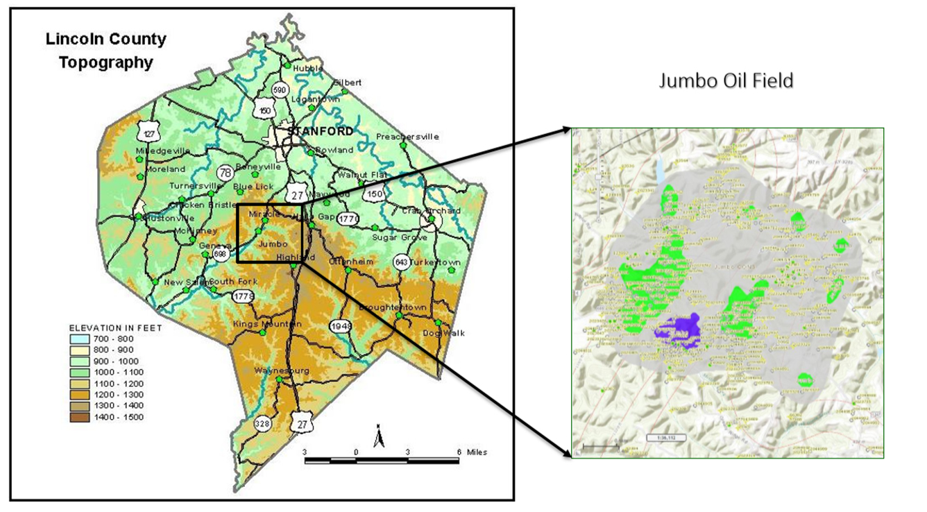
Lincoln County
Structurally Jumbo Oil Field lies along the Northern tip of the Cincinnati Arch. Cincinnati Arch is the manifestation of the Appalachian Foreland Bulge.
Foreland Bulge has two culminations: Jessamine Dome in North and Nashville Dome in the South. Both domes are separated by Cumberland saddle.
Lincoln County lies in the Southern part of the Jessamine Dome. Oil accumulations have both structural and stratigraphic control.
MEADE & MEADE LEASE
- Northern Lease (red boundary)
- 180 Acres
- Total 11 wells
- Active wells: 3
- Silurian – Devonian Corniferous mixed Siliciclastics & Carbonates
- Depth: ~ 150 – 350 ft
- Light Oil: 37o API
- New drill potential down to Knox Group
TOMMY OWENS LEASE
- Central Lease (blue boundary)
- ~ 50 Acres
- Total 11 wells
- Active wells: 2
- Silurian – Devonian Corniferous mixed Siliciclastics & Carbonates
- Depth: ~ 150 – 350 ft
- Light Oil: 37o API
- New drill potential down to Knox Group
YADEN-EMERSON LEASE
- Southern Lease (black boundary)
- ~ 40 Acres
- Total 7 wells
- Active wells: 4
- Silurian – Devonian Corniferous mixed Siliciclastics & Carbonates
- Depth: ~ 150 – 350 ft
- Light Oil: 37o API
- New drill potential down to Knox Group